Walking in Provence
From the Cote d’Azur to the Haute Alpes, Provence is a vast region whose massive appeal has long attracted visitors, year after year without fail.
Within its stunning landscape lie many sub-regions, each with its own personality; in recent years one of the most popular ways to discover this ‘real’ Provence has been on foot.
As walking has grown in popularity, an increasing number of routes have been way-marked and there are now many ‘TopoGuides’ available, published by the Fédération Française de la Randonnée Pedestre. Also, tourist offices can often provide details of local walks with route descriptions usually available at little, or no, cost.
The following offers a whistle-stop tour of some of the main walking areas within the region’s six departments. While some of these are relatively close to one another, it would prove difficult to visit more than two or three during the course of a holiday due to the region’s size.
North (Drome Provencal)
The Drome river and its valley lend their names to a lovely, little-known area just to the north of what would normally be considered Provence. Centred on the ancient towns of Die, Saillans and Bourdeaux, this is glorious walking country with the secretive Foret de Saou at its heart. The towering peaks of Les Trois Becs, culminating in Le Veyou at almost 1600 metres, stand guard over meadows dancing with butterflies in the summer months.
East (Alpes Maritime)
The Mercantour National Park boasts 600 kilometeres of way-marked footpaths, vertiginous views and an abundance of Alpine flora and fauna. Close to the Italian border, at its heart lies the lonely Vallee des Merveilles, famous for its Bronze Age stone carvings.
Central (Alpes de Haute Provence)
The most spectacular feature for miles around, the Gorges du Verdon, is reckoned to be one of Europe’s top landmarks. Hikes through this dramatic limestone country include the famous Sentier de Martel, named after the Frenchman who first found his way into the canyon while surveying the river in 1905. Don’t be fooled by distance (9.3km one-way) – this walk is not for the fainthearted, clinging to the sheer rock face at points and descending the infamous Brèche Embert ladders before exiting the gorges through a long tunnel blasted through the rock.
Due west of here, offering easier walking, lies the hilly Luberon (‘Grand’ and ‘Petit’) whose pretty hill villages and countryside around (immortalised by Peter Mayle in his book A Year in Provence – Menerbes) are a delight to explore on foot.
West (Vaucluse)
The limestone landscape around les Baronnies and Mont Ventoux provides some excellent walking opportunities. Reaching the top of Mont Ventoux, its shimmering white peak a beacon for miles around, is a serious challenge for both walkers and the thousands of cyclists who make the pilgrimage to this infamous Tour de France summit each year. But there are plenty of other walks in the area to explore, including the lovely Gorges de la Nesque, Rocher St Julien and Dentelles de Montmirail.
South-West (Bouches-du-Rhone)
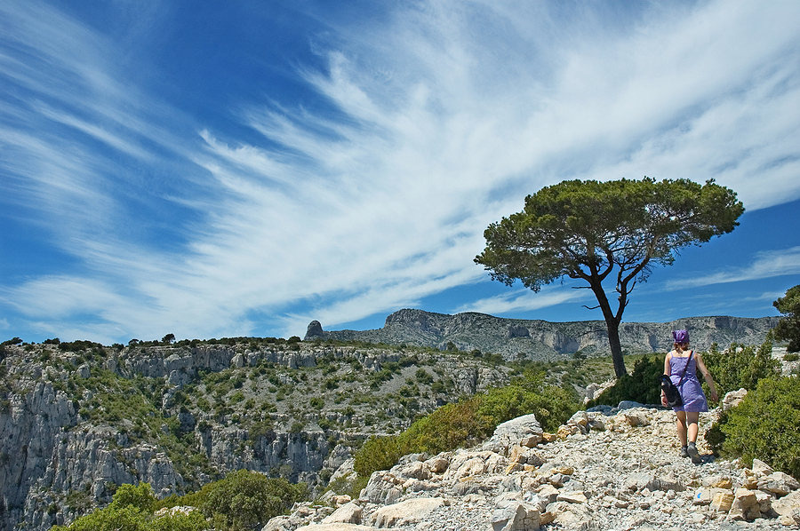
The craggy Alpilles, beloved of Van Gogh, lie to the north of the ancient Roman city of Arles – cultural and administrative centre of this department. While picturesque, the walking is less strenuous here as their highest point falls just short of 500 metres. Trails abound with opportunities to visit spots captured on canvas by the famous painter, especially in and around the town of St Remy de Provence.The coastline here offers walkers two very different areas to explore – Les Calanques National Park, (between Marseille and Cassis) to the east and the vast, flat wetland reserve of the Camargue to the west with its distinctive culture and wildlife.
Les Calanques are fjord-like features formed where rocky headlands plunge their feet into the Mediterranean Sea. As in all parts of this rocky, sun-baked province, stout footwear (and a good, local map) is essential for exploring them, along with sun protection and plenty of water. In arid southern Provence, fire is a constant threat during the summer months and visitors must heed the local warning system which can ban access to certain areas when the risk is considered too great.
South (Var)
East, towards St Tropez, lies the lonely Massif de Maures. This large rocky headland with its scrub-covered ravines, is home to the réserve naturelle nationale de la Plaine des Maures – sanctuary of the wild Hermann tortoise and other rare species. Offshore, Port-Cros one of the Hyeres islands, is a bird and marine reserve.
Across the Bay of St Tropez, beyond Frejus, the land rises again to form the Massif de l’Esterel, whose trails offer spectacular views over the French Riviera. Cork oak, stunted pine trees, wild herbs and heathers thrive on its ancient, red volcanic rock.
If you’re thinking of travelling to the South of France why not take a look at our latest Travel Guide to the region.
For more information about holidaying in the South of France, visit the official Provence, Alpes, Cote d’Azur Tourism website.